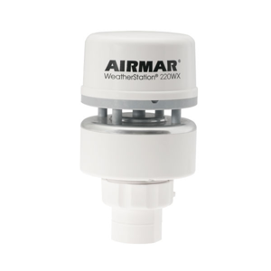
220WX WeatherStation® Instrument
Part Number220WX
NOTE: AIRMAR NO LONGER MANUFACTURERS THIS MODEL, PLEASE SEE WEATHERSTATION® INSTRUMENTS FOR AVAILABLE MODELS.
Commercial Fishing
The patented 220WX is Airmar’s solution for commercial-fishing weather-monitoring applications. Feature rich in a durable, rugged, small footprint that is IPX6 rated, the 220WX calculates the theoretical wind speed and direction based upon the apparent wind, speed of the vessel, and vessel heading.
The 220WX has an internal, 10 Hz GPS and three-axis electronic compass. These sensors give heading, position, speed-over-ground, and course-over-ground functionality that is required for theoretical wind-data processing and mobile applications. A 3D compass with dynamic stabilization provided by the three-axis rate gyro also enhances the rate-of-turn data.
- Ultrasonic measurement of apparent and theoretical wind speed and direction
- Barometric pressure
- Air and wind chill temperature
- GPS position, speed over ground, and course over ground
- Three-axis, solid-state compass with dynamic stabilization
- Three-axis rate gyro supplies rate-of–turn data
- Three-axis accelerometer for best-in-class pitch and roll information
- Housing IPX6 rated for water-ingress protection
- Data output via a single cable (various lengths available)
- NMEA 0183/ASCII serial data protocol over RS-232 interface
- NMEA 2000® protocol over CAN
Options
- Relative humidity module
- Enables dew-point and heat-index calculations
- Field serviceable
- WeatherStation housing rated IPX4
- Air Temp Accuracy: ±1.1°C at 20°CAir Temp Range: -40 to 80°C (-40 to 176°F)Air Temp Resolution: 0.1°CApparent Wind Speed and Angle: YesBarometric Pressure Accuracy: ±0.5 hPa at 25°C (or better)Barometric Pressure Range: 300 to 1100 hPaBarometric Pressure Resolution: 0.1 hPaCerts And Standards: CE, IPX6 (IPX4 with optional Relative Humidity sensor), RoHS, IEC61000-4-2, IEC60945, IEC60950_1C, IEC60950_22A, EN55022, EN55024, EN14982Communications Available Hardware Interface: Serial RS232, Serial RS422, CANCommunications Available Protocol: Comma delimited ASCII, NMEA 0183, NMEA 2000Communications Serial Output Rate: 1 Hz typical. User selectable. 10 Hz maximum recommendedGPS Position Accuracy: 3 m (10') CEPHumidity: OptionalMounting Thread: Standard 1”-14 UNS (3/4” NPT optional)NMEA 2000 LEN: 2Note: Cables sold separately unless otherwise specifiedOperating Temp Range: -25 to 55°C (-13 to 131°F)Optional RH Accuracy: ±5% RH at 0 to 90% RH at 20°COptional RH Range: 0 to 100% RHOptional RH Resolution: 0.1% RHPitch Roll Accuracy: ±1° in range of ±30°Pitch Roll Measurement Type: MEMSPitch Roll Range: 50°Pitch Roll Resolution: 0.1°Power Supply Current: <75 mA (<0.9 W) at 12 VDCPower Supply Voltage: 9 to 40 VDCStationary: YesTheoretical Wind Speed and Direction: YesThree Axis Compass Dynamic Heading Accuracy: 2° dynamic heading accuracyThree Axis Compass Range: 0 to 359.9°Three Axis Compass Resolution: 0.1°Three Axis Compass Static Heading Accuracy: 1° static heading accuracyWaterproof Rating: IPX6 (Relative Humidity/IPX4)Weight: 300 g (0.7 lb.)Wind Direction Accuracy: ±3° at 10 m/sWind Direction Calculations: User configurable dampingWind Direction Range: 0° to 359.9°Wind Direction Resolution: 0.1°Wind Speed Accuracy: 5% at 10 m/s (19 knots) at 4 anglesWind Speed Calculations: User configurable dampingWind Speed Range: 0 to 40 m/s (0 to 89 MPH)Wind Speed Resolution: 0.1 m/s
Serial Data Output Protocol
NMEA 0183 Sentence Structure – Comma Delimited ASCII Format $GPDTM GPS Datum Reference $GPGGA GPS Fix Data $GPGLL Geographic Position—Latitude and Longitude $GPGSA GNSS DOP and Active Satellite $GPGSV Satellites in View $GPRMC Recommended Minimum GNSS $GPVTG COG and SOG $GPZDA Time and Date $HCHDG Heading, Deviation, and Variation $HCHDT True Heading $HCTHS True Heading and Status $TIROT Rate of Turn $WIMDA Meteorological Composite $WIMWD Wind Direction and Speed $WIMWV Wind Speed and Angle $WIMWR Relative Wind Direction and Speed $WIMWT Theoretical Wind Direction and Speed $YXXDR Transducer Measurements CAN Data Output Protocol
NMEA2000® Output Message Structure
59392
ISO Acknowledgement
060928
ISO Address Claim
126208
Acknowledge Group Function
126464
PGN List
126992
System Time
126996
Product Information
126998
Configuration Information
127250
Vessel Heading
127251
Rate of Turn
127257
Attitude
127258
Magnetic Variation
129025
Position and Rapid Update
129026
COG and SOG, Rapid Update
129029
GNSS Position Data
129033
Time and Date
129044
Datum 129538
GNSS Control Status 129539
GNSS DOPs 129540
GNSS Sats in View 130306 Wind Data 130310 Environmental Parameters 130311 Environmental Parameters 130312 Temperature 130313 Humidity 130314 Actual Pressure 130323 Meteorological Station Data